Preserving History in 5 weeks: Monitoring the Giza Pyramids' Stability with Remote Sensing Innovations

The Challenge

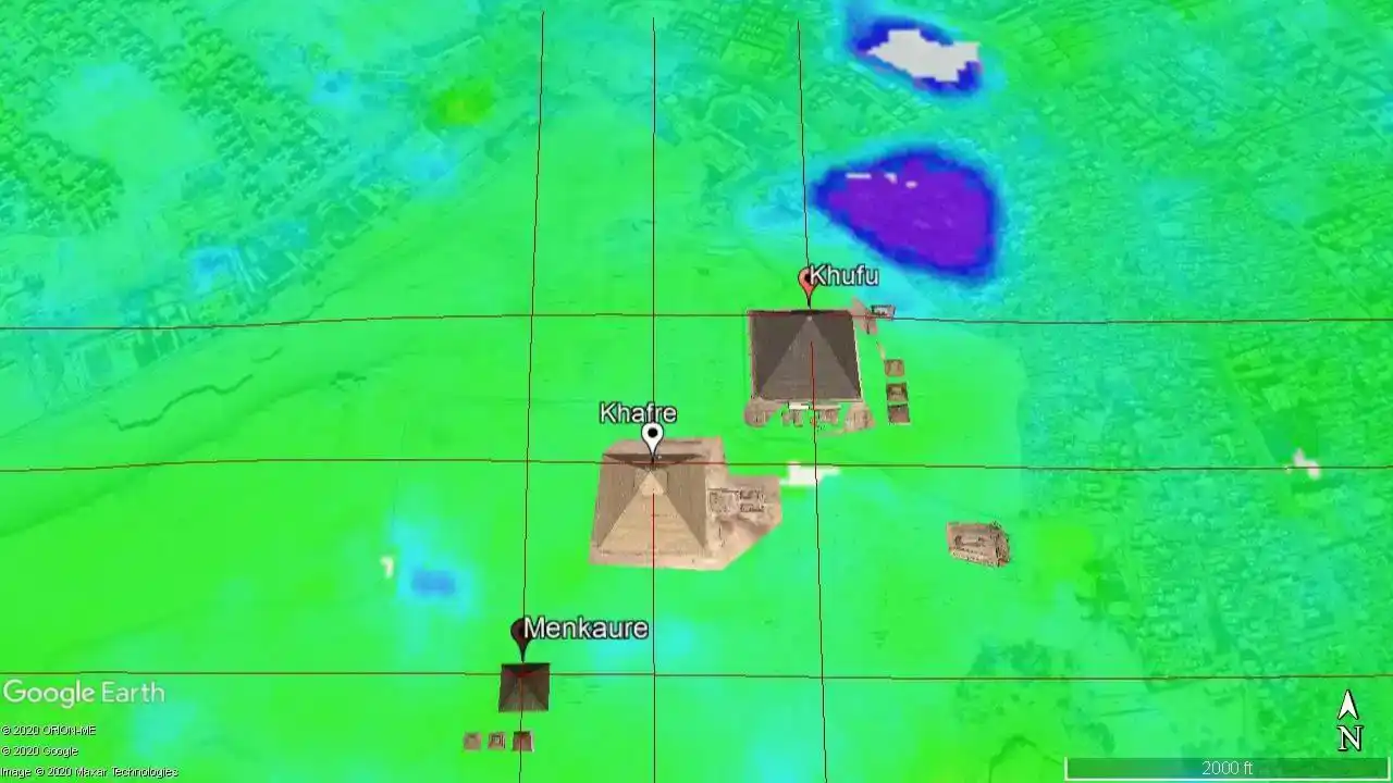
The Giza Plateau is home to some of the most treasured symbols of human history. The Great Pyramids of Khufu, Khafre, and Menkaure. Built over 4,500 years ago, these monumental structures have endured the test of time as the last surviving wonder of the ancient world, exemplifying both the ingenuity of early civilizations and the cultural identity of Egypt.

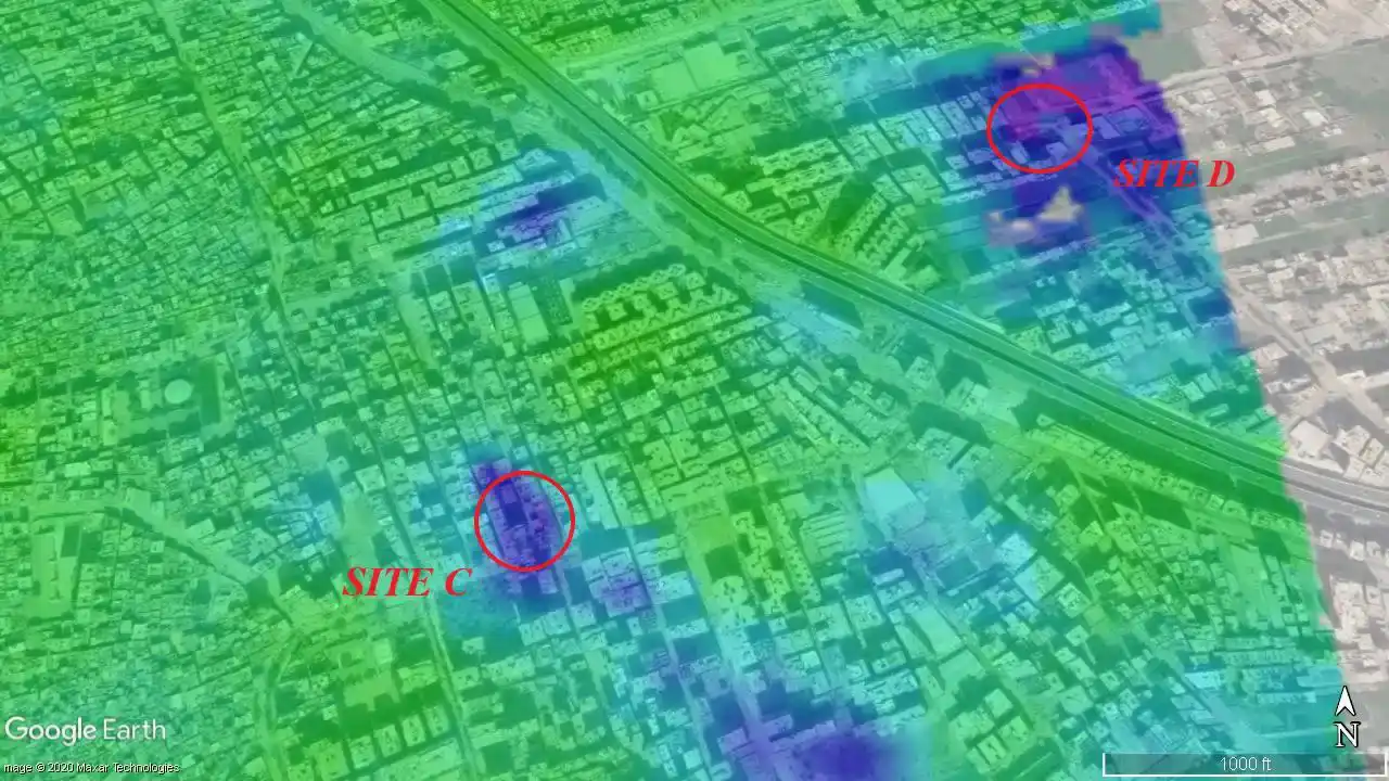
However, the stability of these iconic structures is under growing threat. Urban expansion is bringing roads and buildings dangerously close, while rising groundwater, changing temperatures, and strong desert winds are gradually impacting the ground and surrounding environment. Without effective monitoring, these hidden dangers can lead to significant damage over time.

To protect these collective treasures, a reliable and non-intrusive method was essential for detecting even the slightest ground movements. The challenge lay in leveraging modern technology to deliver precise, detailed data on the pyramids' stability, all while ensuring that the historical site remains undisturbed.

UNESCO Giza Pyramids monitoring system showing SAR interferometry analysis

The Solution

To address these challenges, advanced Synthetic Aperture Radar (SAR) Interferometry was employed, utilizing Sentinel-1 satellite imagery and the Small Baseline Subset (SBAS) algorithm. Over an 11-month period, this sophisticated monitoring system delivered high-resolution, millimeter-level precision data on the surface deformation of the Pyramids and the surrounding urban areas. The process was facilitated by ENVI SARscape software, which enabled interferometric stacking and time-series analysis to detect subtle displacement trends.

Central to this solution was SAR Interferometry, a radar-based technique that ensured exceptional accuracy in detecting ground displacement. The Sentinel-1 C-Band Satellites provided essential free, high-resolution data, perfectly suited for monitoring expansive areas over time. The SBAS algorithm was crucial in navigating the complexities of low-coherence regions, such as deserts and urban landscapes. ENVI SARscape Software completed this advanced analytical framework, expertly processing, analyzing, and visualizing the SAR data. This integration of technologies delivered invaluable insights into subtle ground movement dynamics, offering a detailed understanding of displacement trends in the monitored areas.

UNESCO heritage site displacement visualization with millimeter-precision measurements

The Result

Our research uncovered fascinating insights into the stability of the Great Pyramids and their surrounding urban areas. The Pyramids themselves exhibited remarkable spatial stability, with negligible displacement trends measured between -2 to +3 mm per year, highlighting their enduring resilience. In contrast, nearby urban areas told a different story, experiencing significant subsidence of over -60 mm per year,linked to factors such as water pumping and uncontrolled construction activities. This study not only highlighted the effectiveness of using Sentinel-1 satellite imagery alongside the SBAS algorithm as economical tools for large-scale heritage monitoring but also demonstrated their vital role in broader applications.

The impact of these findings is significant. It empowers heritage managers by equipping them with precise data crucial to develop long-term preservation strategies. Additionally, the study highlights the critical need for sustainable urban development to protect irreplaceable historical sites. The demonstrated success of this SAR-based monitoring approach also points to its scalability, offering a reliable method for safeguarding cultural treasures around the world.

Project tech stack

ENVI SARscape Logo

ENVI SARscape

Sentinel-1 Logo

Sentinel-1 C SAR Imagery

SBAS Algorithm Logo

SBAS Algorithm

Long-term wins

Global support for monitoring UNESCO World Heritage sites using SAR technology
Support sustainable urban planning by identifying subsidence risks near historical sites
Enhanced study of climate impacts on arid regions