
Egypt's agriculture is a cornerstone of the country's economy, feeding millions and employing a substantial portion of the population. However, the sector faces significant challenges such as water resource management, land overuse, and maintaining food security. To tackle these issues, the Ministry of Agriculture needed a scalable solution to obtain real-time, precise data on crop health, water usage, and land productivity nationwide, utilising advanced remote sensing and geospatial technologies.
Tomorrow's Climate Challenges: Simulating 2050 Submergence Scenarios in the Northern Nile Delta
The Challenge

The Solution
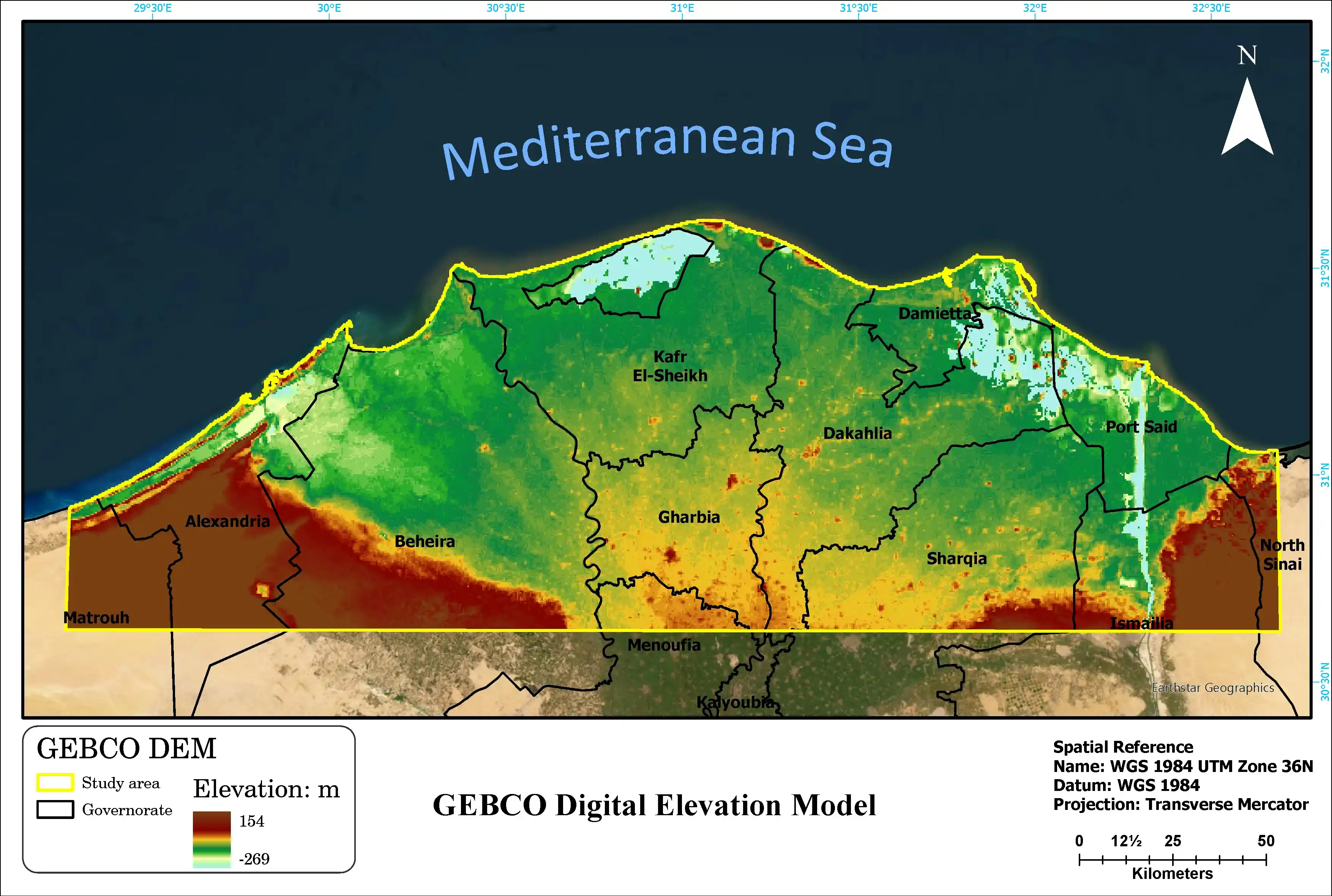
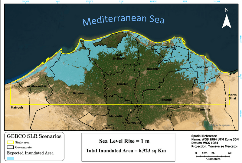
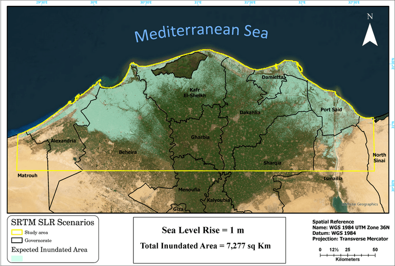
To confront these challenges, the study implemented advanced geospatial techniques to simulate future submergence scenarios in the northern Nile Delta using high-resolution geospatial data from Shuttle Radar Topography Mission (SRTM) and General Bathymetric Chart of the Oceans (GEBCO) digital elevation models (DEM). By modeling sea level rise (SLR) scenarios ranging from 1 to 4 meters, we identified critical vulnerabilities and created risk maps to offer insights into the impact of different inundation levels, pinpointing areas needing urgent action. Using ArcGIS Pro, geospatial analysis tools further supported this effort by assessing elevation dataset reliability and producing detailed maps for key cities and agricultural zones.
The study leveraged cutting-edge technology, starting with the Shuttle Radar Topography Mission (SRTM), providing high-resolution Digital Elevation Models (DEMs) with exceptional 30-meter spatial accuracy, crucial for accurate mapping and vulnerability assessment. Complementing this, the General Bathymetric Chart of the Oceans (GEBCO), a global terrain model whose coarser resolution is offset by its solid validation through a variety of geophysical techniques, enabling far-reaching and reliable analyses. Tying everything together was ArcGIS Pro, a powerful GIS software by ESRI, which streamlined data processing and raster calculations, while enabling sophisticated sea level rise (SLR) modeling.
The Result
The study's results highlight significant risks from rising sea levels on the Nile Delta. With just a 1-meter rise, Port Said and Damietta could see over half of their areas submerged. A 2-meter rise poses serious threats to Dakahlia and Kafr El-Sheikh, with flooding covering more than 40% of these regions. The scenario becomes catastrophic at 4 meters, risking near-total submergence of Damietta and significant loss in Alexandria. This analysis demonstrates the complementary strengths of SRTM's high spatial precision and GEBCO's broad-scale capability. The findings offer critical insights for coastal risk assessment, informing flood defenses, urban planning, and water management strategies, while also proving the value of freely accessible DEMs in large-scale environmental studies.
Project tech stack


Image Analyst


Spatial Analyst

ArcGIS Pro
Long-term wins
Support for climate change adaptation strategies
Enhance global sea-level rise analysis with freely accessible DEM-based simulations
Support coastal adaptation strategies with data-driven flood defense planning