
Egypt's agriculture is a cornerstone of the country's economy, feeding millions and employing a substantial portion of the population. However, the sector faces significant challenges such as water resource management, land overuse, and maintaining food security. To tackle these issues, the Ministry of Agriculture needed a scalable solution to obtain real-time, precise data on crop health, water usage, and land productivity nationwide, utilising advanced remote sensing and geospatial technologies.
Advancing Sustainable Agriculture in Egypt through GeoAI and Geospatial Technology
The Challenge

The Solution
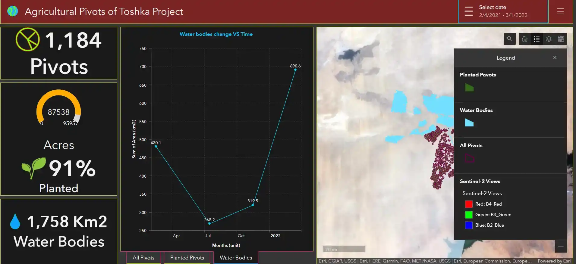
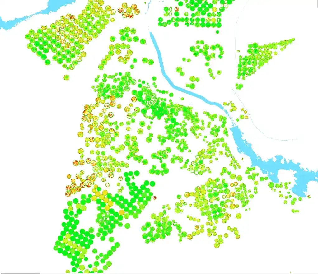
To address these agricultural challenges, an innovative geospatial workflow was designed and deployed, leveraging ArcGIS Pro alongside high-resolution PlanetScope optical imagery. This approach involved crucial steps such as the integration of imagery through mosaicking and preprocessing to create seamless datasets for comprehensive analysis. Precision land classification was achieved by combining supervised classification with a custom AI-trained model, allowing for accurate extraction of agricultural pivots. Vegetation health was closely monitored using the Normalized Difference Vegetation Index (NDVI), providing valuable insights into crop health and productivity. Additionally, water surface analysis was conducted to estimate and manage irrigation needs. A significant feature of this solution was the development of an interactive dashboard on ArcGIS Online, which offered policymakers an intuitive platform to access real-time insights for informed decision-making. By integrating cutting-edge technologies like ArcGIS Pro and PlanetScope imagery, coupled with advanced analytical tools such as AI models and NDVI, this solution set a new standard in agricultural monitoring and resource management.

The Result
The project delivered transformative results, providing actionable insights into Egypt's agricultural landscape. Through NDVI analysis, we identified distinct vegetation health patterns, highlighting areas needing intervention to boost crop vitality. This precise data also improved resource management by accurately tracking irrigation usage and identifying regions of water overuse. The interactive dashboard became a powerful tool for decision-makers, equipping them with real-time insights and visually driven data to take swift, informed actions that enhance agricultural productivity. By fostering informed water management and strategic land use, the project significantly advanced sustainable agriculture. It also improved food security by optimising productivity in underperforming areas. Integrating remote sensing into national strategies, this initiative effectively embedded advanced technologies into policy, paving the way for a more resilient agricultural future.
Project tech stack


ArcGIS Online

PlanetScope Optical Imagery


ArcGIS Pro
Long-term wins
Enable AI-driven precision irrigation and drought forecasting for sustainable agriculture
Automate crop monitoring and resource allocation with satellite-powered smart farming
Integrate geospatial insights into national policies to drive food security and sustainability